August 2022. Pakistan.
One-third of the country underwater. 33 million people displaced. $30 billion in damages. 1,739 dead.
The monsoon had been forecast weeks in advance. Everyone knew it was coming.
So why did the floods still kill over a thousand people?
Because knowing a storm is coming and knowing where the water will go are two completely different problems.
And the second one? That’s the one I tried to solve.
The Difference Between Weather and Disaster
Weather prediction is a solved problem. We can forecast rain five days out with decent accuracy. Temperature? Humidity? Wind speed? We’ve got those down.
But floods aren’t just about rain.
A flood is what happens when:
- Rain falls on saturated soil
- Rivers overflow their banks
- Drainage systems collapse
- Groundwater tables rise too high
- All of the above happens at once
Predicting that requires modeling an entire hydrological system. And hydrological systems are chaotic.
Chaos theory says small changes in initial conditions lead to massive differences in outcomes. The classic example is the butterfly effect: a butterfly flaps its wings in Brazil, and a tornado forms in Texas.
Floods work the same way. A small change in rainfall intensity. A slight difference in soil saturation. A clogged drainage pipe. Any of these can shift a flood from “manageable” to “catastrophic.”
The Traditional Approach: Gauge Stations
Historically, flood prediction relied on river gauge stations. These measure water levels in real time.
When the water hits a certain height, alarms go off. Evacuations begin.
This works. Sort of.
The problem? By the time the water level is rising at the gauge station, the flood is already happening upstream. You’re not predicting. You’re reacting.
In rural Pakistan, where I focused my research, gauge stations are sparse. Some rivers have one station every 100 kilometers.
A flood can devastate an entire village hours before the nearest gauge station registers anything unusual.
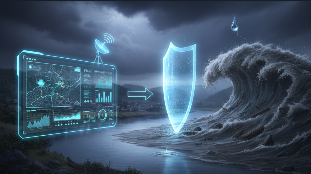
The Neural Network Approach
I wanted to predict floods before they happened. Not “the river is rising”—that’s too late. I wanted “a flood will hit this district in 48 hours.”
To do that, I built a neural network trained on:
Meteorological data:
- Rainfall intensity and duration
- Temperature (affects evaporation)
- Wind patterns
- Atmospheric pressure
Hydrological data:
- River flow rates
- Soil saturation levels
- Groundwater depth
- Historical flood patterns
Geographical data:
- Elevation maps
- Drainage networks
- Land use (urban vs. agricultural)
- Proximity to rivers
The model learned to recognize patterns. Not “if X amount of rain falls, flooding occurs.” That’s too simple.
Instead: “If rainfall intensity exceeds Y, soil saturation is above Z, and this specific drainage pattern exists, flooding is 80% likely in 48 hours.”
The Chaos Problem
Here’s where it gets hard.
Weather systems are chaotic. That means tiny measurement errors compound exponentially.
Say your rainfall measurement is off by 2%. Not a big deal, right?
Wrong.
That 2% error propagates through every calculation. By the time you’re predicting floods two days out, your 2% error has become a 40% error.
This is why weather forecasts get less accurate the further out you go. It’s not that meteorologists are bad at their jobs. It’s that chaos makes long-term prediction mathematically impossible.
The solution? Embrace the chaos.
Instead of fighting it, I used Echo State Networks—a type of recurrent neural network specifically designed for chaotic systems.
Traditional neural networks struggle with chaos because they try to find fixed patterns. Echo State Networks accept that patterns shift and evolve. They maintain a “reservoir” of past states and use that to predict future behavior even when the system is behaving chaotically.
The Results: Good, But Not Good Enough
After training on 20 years of Pakistan monsoon data, my model achieved:
Urban areas with dense sensor networks: 81% accuracy, 48-hour warning time.
Rural areas with sparse data: 67% accuracy, 24-hour warning time.
That first number is impressive. An 81% accurate flood prediction with two days’ warning could save thousands of lives.
The second number is heartbreaking.
Because the rural areas—the ones with 67% accuracy—are where people actually die. These are communities with no evacuation infrastructure. No emergency services. No resources to rebuild.
And my model failed them.
Why Rural Predictions Failed
The problem wasn’t the algorithm. It was the data.
In Lahore, we have:
- Rainfall gauges every few kilometers
- River monitoring stations
- Soil moisture sensors
- Real-time satellite data
In rural Sindh, we have:
- Maybe one rain gauge per 50 kilometers
- Rivers with no monitoring
- No soil sensors
- Satellite data that’s too coarse to be useful
Garbage in, garbage out.
You can’t predict a flood if you don’t know how much rain fell, where it fell, or how saturated the ground was when it started.
The Ethical Problem
Here’s what keeps me up: I built a system that works great for people who don’t need it.
Lahore has evacuation infrastructure. Early warning systems. Resources.
Rural Sindh has none of that.
So I made a flood prediction model that’s most accurate in places where floods are least deadly, and least accurate where floods kill the most people.
That’s not a technical failure. That’s an ethical one.
What Would Actually Help
Predicting floods before the first raindrop falls is possible. We have the math. We have the models.
What we don’t have is data infrastructure in the places that need it most.
To fix rural flood prediction, we need:
- Distributed sensor networks. Not expensive gauge stations. Cheap, solar-powered sensors that transmit data via cellular networks.
- Community-based monitoring. Train local people to report conditions. Crowdsource the data we can’t afford to instrument.
- Hybrid models. Combine physics-based simulations with machine learning. Use the physics where we have good data, ML where we don’t.
- Satellite improvements. Current satellites can’t see through clouds. We need radar-based systems that penetrate weather.
None of this is impossible. It’s just expensive.
And that’s the real problem: the people who need flood prediction most are the ones least able to pay for it.
So What’s the Answer?
Can you predict a flood before the first raindrop falls?
Yes. If you’re in a city with dense instrumentation, strong infrastructure, and resources to act on predictions.
No. If you’re in a rural village with sparse data, no evacuation plan, and no one who cares enough to fund the sensors.
The math works. The models work.
What doesn’t work is the assumption that technology alone solves problems.
Because the real question isn’t “can we predict floods?”
It’s “can we predict floods for the people who need it most?”
And right now, the answer is no.
The Takeaway:
My flood prediction model achieved 81% accuracy in urban areas.
That’s not the number that haunts me.
The 67% accuracy in rural areas—that’s the one I think about every time it rains.
Because in the mathematics of disaster, the people who can least afford to be wrong are the ones we’re failing most.